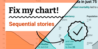
Fix my chart » Map annotations


Welcome back to Fix My Chart, an advice column for all your data visualization questions. We look at real charts, maps, and tables, and figure out how to solve their problems together. Does your chart need a tune-up? Write in here!
Dear Rose,
I have a general question, and I’m attaching a map I'm working on as an example: How do you handle annotations? Especially on a detailed map like this one.
![[aria-description]](https://datawrapper.dwcdn.net/zeNjr/full.png)
So many interesting things in there! So many things I want people to notice! But when I add annotations to point them out, the map looks cluttered, and the annotations overshadow the actual data points. I admire the elegant annotations in visualizations by the New York Times and the Washington Post, but I can’t seem to replicate them.
Plus, it looks messy on mobile…
So, how do you manage annotations to improve the look of the map? Any advice would be greatly appreciated.
Thank you!
Evan
Dear Evan,
Annotations leave you a lot of freedom to make your own design choices. Which points are worth noting? What should the notes say and how should they be styled? How should they relate visually to the map itself? All that freedom can be overwhelming, of course — but as you say, it’s also exactly where the most elegant maps really stand out. So let’s see what we can do to make your map look its very best!

Fixing a cluttered visualization is often as simple as deleting its least important elements — but in this case, I’d say that’s not your problem. Your annotations point out interesting data patterns that add up to a coherent story about regional power industries in the U.S. Plus, they’re already well spread out across the map, which means a few visual tricks should be enough to give them the room you want.
- First, let’s give this whole map more space to breathe by adding 5% padding around its borders.
- Next, we’ll get rid of the city labels. Extra text steals attention from your annotations, which already mention enough states and regions to help the reader get oriented.
- Since you’re describing regional patterns rather than labeling specific data points, let’s use circles instead of arrows to connect annotations with the map.
- Finally, reusing your data colors for the annotations helps them sit back onto the map instead of jumping off it in an attention-grabbing way. The patterns you’re pointing out can be explored in any order as the reader’s eye wanders across the page — it’s better to let the text blend in with the data rather than demanding to be read right away.
![[aria-description]](https://datawrapper.dwcdn.net/ZWLMi/full.png)
Here’s a look at my final version. If you’re reading along, hover on the map’s top right corner and click “Edit this chart” to explore a copy in your own Datawrapper account.
See you next time,
Rose
My mailbox is open for your letters with questions, struggles, and every kind of data vis consultation. I’m looking forward to hearing from you!