Radish to romanesco: A year in vegetables
February 20th, 2025
4 min
This article is brought to you by Datawrapper, a data visualization tool for creating charts, maps, and tables. Learn more.

Hi, this is Aya from the support team. You can find me on the other end of support@datawrapper.de, answering your questions about Datawrapper. This week, I want to talk about streets and trees.
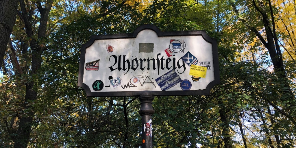
Autumn is a beautiful time of the year. All the leaves turn into different shades of warm colors. As I cycled through Berlin from the famous boulevard “Unter den Linden” (under the linden trees) to “Ahornsteig” (maple path), I wondered about all the trees and the streets named after them, and decided to do some research.
There are around 431,000 trees on the streets of Berlin, not counting all the trees in parks and forests. They are pretty – but they also play a crucial role in the city’s sustainability: They protect us from the rain & storm, collect dust particles and clean the air, and provide us with some mental peace.

The five most common types of tree make up 75% of the total street tree stock. Here’s a list:
I noticed that many trees are deciduous, meaning the leaves will turn yellow and fall in the winter. The city plants mostly deciduous trees because they will shade us in the summer and let the sun warm us in the winter.
For the table above, I drew the leaves myself[1] – which encouraged me to look closer at their details. Now I can tell the difference between a leaf of a plane tree and a maple tree (Plane trees have three main veins while maples have five or seven main veins.)
Now that we know about street trees, let’s talk about tree streets. I had been quite obsessed with street addresses recently[2]. While doing some research, I found a ZEIT Online article called “Streetscapes” that tells the story behind the 450,000 German street names. The authors explain:
Most groups of streets are named after trees, birds, composers, and poets… Baumviertel (or tree quarters) and Vogelquartiere (bird quarters) can be found with particular frequency.”
I wanted to see for myself whether I could find these patterns in the streets named after trees. Here are more than 250 out of the 13550 streets in Berlin (1.8%) that are named after common trees:
As you can see, streets with tree names are often grouped to “Baumviertel”, just as the article had suggested. Also, the number of streets named after a tree somehow reflects the number of trees in the city. For example, linden makes up a third of the total tree stock, and streets with “Linde” in their names were the most common.
This map was made possible with the ZEIT Online article. They use data collected from OpenStreetMap data and prepared by Geofabrik. I downloaded the data from their article, then filtered out the data for Berlin[3].
I selected the street names with the names of the trees from the table above, plus a few more. Then I exported the street geodata as GeoJSON and uploaded it to Datawrapper. And because our locator maps are not zoomable but I wanted to offer close-up views anyway, I inserted a PNG of a zoomed-in version of the same map.
My next question was: Do individual tree street names reflect the trees planted there? How do I find out?
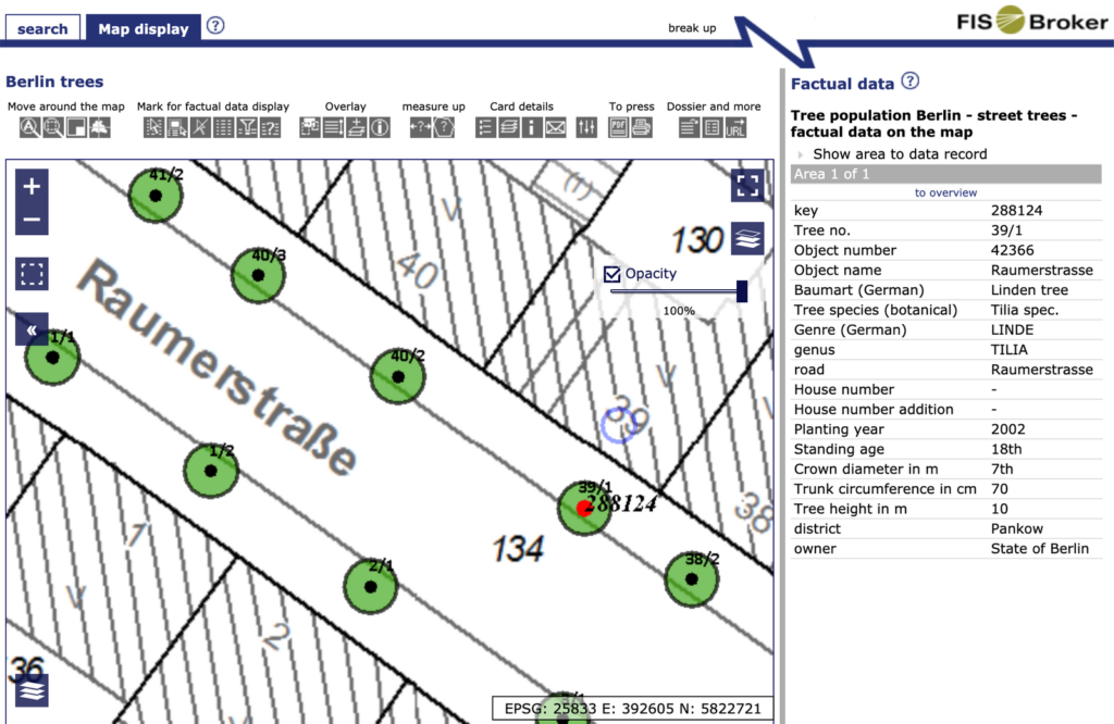
Well, the state of Berlin has a data portal called FIS Broker, which allows you to access all kinds of public data. This includes street tree data (Straßenbäume) in Berlin. It’s pretty amazing.

You can find all kinds of information about a specific tree in the FIS Broker. For example, the one in front of our office on Raumerstraße has the ID 288124 and is a common linden tree planted 18 years ago. You can also search by street and find out what type of trees are planted there.

So, let’s find out whether Unter den Linden has linden trees. Turns out, it does: Unter den Linden has 252 id-ed trees, and each of them is one of five species of linden, on average 8m in height and 42 years in age. I also checked the trees in streets named after maples (Ahorn) and planes (Platane), and yes, most trees there are nicely consistent with the street name.
If you’re curious, many other cities have great interactive maps and databases on their street trees: New York City, London, Paris … just to name a few.
I struggled to come up with an insight worth sharing through this little research. But I learned many interesting things along the way: I look at trees a little differently now when I walk on the streets. I read the street signs with more curiosity. I’ve learned a few German words. I discovered tonnes of data in FIS Broker that looks super interesting to explore in the future.
Maybe, sometimes it’s ok not to have a punch-line in your visualizations.
That’s it for this week! What kind of trees are on your street? Have you created visualizations using tree data in your city? Feel free to drop me an email with the answers to those questions at aya@datawrapper.de or leave a comment below. See you next week!
Comments