

The world could be your oyster, but it depends on your passport
October 10th, 2024
4 min
This article is brought to you by Datawrapper, a data visualization tool for creating charts, maps, and tables. Learn more.
Hi, my name is Anna. I’m responsible for the basemaps at Datawrapper, creating administrative regions (e.g. states or ZIP codes) which you can use when creating symbol or choropleth maps.
My work at Datawrapper is usually about borders defined by humans, but this Weekly Chart is about borders created by nature itself – the sea level.
Long before I started making maps at Datawrapper, I studied archaeology. One thing that I always found intriguing when doing excursions and excavations was the historical changes in the landscape, how the last Glacial Period has affected the shoreline dramatically over the centuries.
For 100,000 years, until ca. 15,000 years ago, almost all of Scandinavia was covered with ice (Weichsel Glacial Period). When the ice started melting, two factors affected the sea level. One was the increased amount of water from the melting ice, and the other was the rebound of the earth’s surface. The weight from the ice pressured the land down, and when the ice receded, the land started to rise.
The Baltic Sea went through four stages during this time – and in all of them, it had different names: Baltic Ice Lake, Yoldia, Ancylus and Littorina.[1]
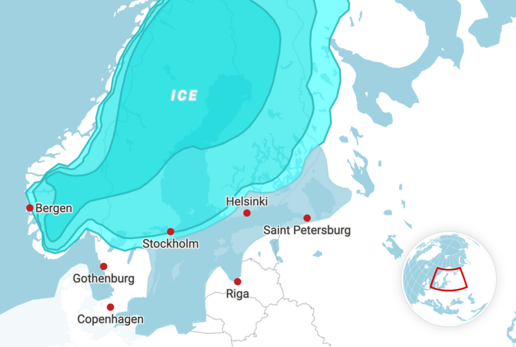
Baltic Ice Lake (14,500 – 11,500 years ago)
The first map shows the Baltic Ice Lake 14,500 – 11,500 years ago, which is a fresh water lake. The level of the lake is higher than the ocean, which means that water flows out (in Öresund), but not in.
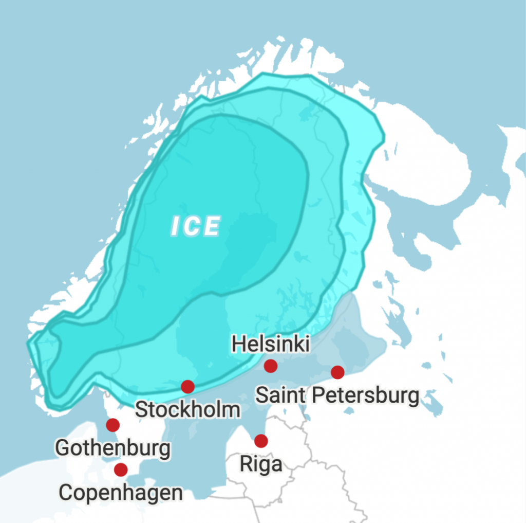
Yoldia Sea (11,500 – 10,700 years ago)
When the ice reaches just north of Mount Billingen, the water of the Baltic Ice Lake can finally gush through a narrow corridor between the ice in the north and the mountain in the south. The level of the lake decreases by 25 meters in just a few years.
During this period, there is a stretch of 200 years of a cooler climate, which stops the ice from melting. The outflow of water into the ocean stops, and salty ocean water can come in through the corridor.
Ancylus Lake (10,700 – 10,000 years ago)
The third map shows the Ancylus Lake 10,700 – 10,000 years ago. Because the heavy ice melts, Scandinavia rises (this is called post-glacial rebound), and the corridor to the ocean at Mount Billingen closes.
The influx of salt water stops, and the Baltic Sea becomes a closed fresh water lake again. Through the continous melting of the ice, the water level rises by 5-10 cm per year. Because of that, a new outlet in the south opens up at the end of the Ancylus lake period.
Littorina Sea (10,000 – 3,000 years ago)
All over the world, the ice melts and flows into the ocean. Scandinavia rises, but not as fast as the global sea level. This leads to a connection between the Littorina Sea and the ocean in the south, where salt water starts to enter. The Scandinavian ice melts completely in this period, so no new fresh water from there flows into the Baltic Sea.
Since this last period, the land level has continued to rise due to post-glacial rebound – and is still rising today by 7 mm per year in the northern parts of the Baltic Sea area.
To visualize the different stages of the Baltic Sea, I used our locator maps with GeoJSON area markers for the ice and the lake. The locator map basemap shows the shoreline of today. If you have feedback, let me know in the comments! I’m looking forward to hearing from you. Until next week!
The names Yoldia, Ancylus and Littorina are all names of water shells and snails that lived in the Baltic Sea during the different stages and can be found in the soil sediments from the different periods.↩︎


Comments