This article is brought to you by Datawrapper, a data visualization tool for creating charts, maps, and tables. Learn more.
Could you add a map of Kirkjubæjarklaustur?

Hi! This is Eleni from the map team. This is my first Weekly Chart, and I’d love to talk about Datawrapper’s basemap library!
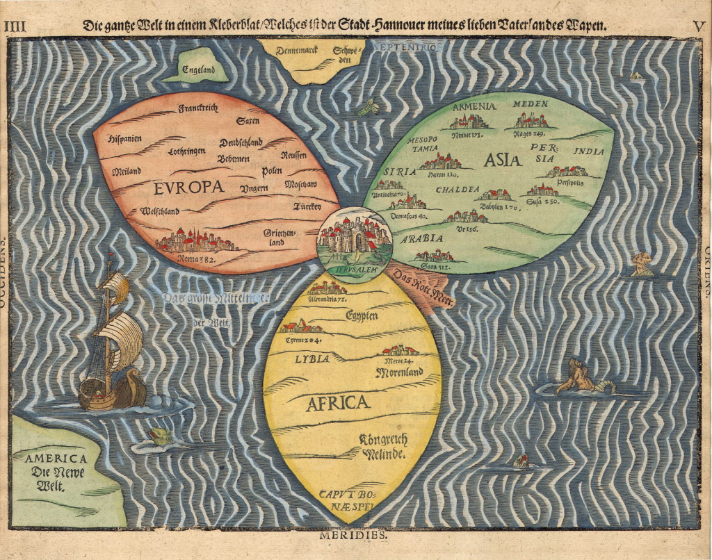
As a cartographer, sometimes I wake up anxious in the night. What if I had to do my job the way maps were made in the past, without satellites or even an aerial perspective?
Cartography: From French cartographie, from carte (“map,” ultimately from Ancient Greek χάρτης khártēs, “map”) + –graphie (“-graphy,” from γράφω gráphō, “write”)
Creating a map back then was an extremely time-consuming process, and to modern eyes, the results can seem quite funny. Early mapmakers often relied on methods like:
- Direct observation, measurements, and information from physical expeditions by scientists and explorers.
- Astronomical observations of the sun, stars, and planets to determine latitude and longitude.
- Triangulation, a method which uses a known distance between two points to calculate the distance to a third point using angles. To do triangulation you need a theodolite, an instrument used for measuring angles in the horizontal and vertical planes — you might actually have seen people still using one, standing in orange vests with a gigantic tripod in the middle of the street. Plot twist: They’re not taking pictures of you!
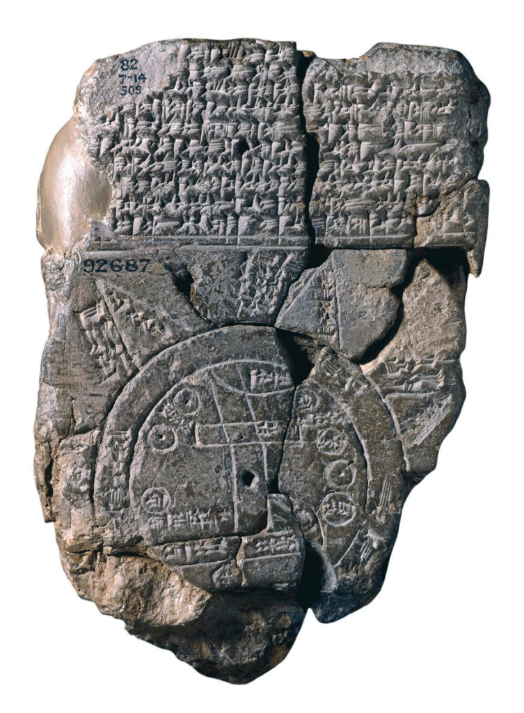
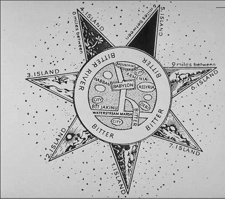
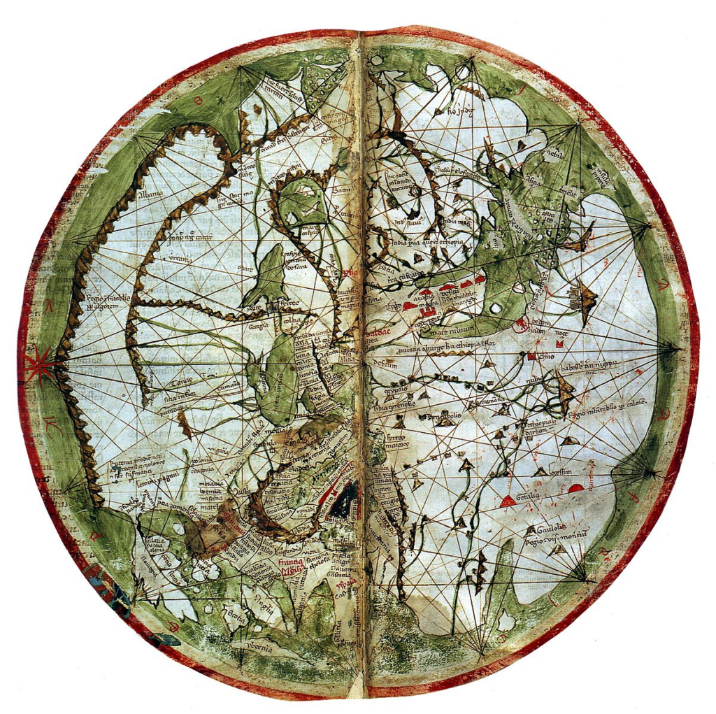
These are some of the results:
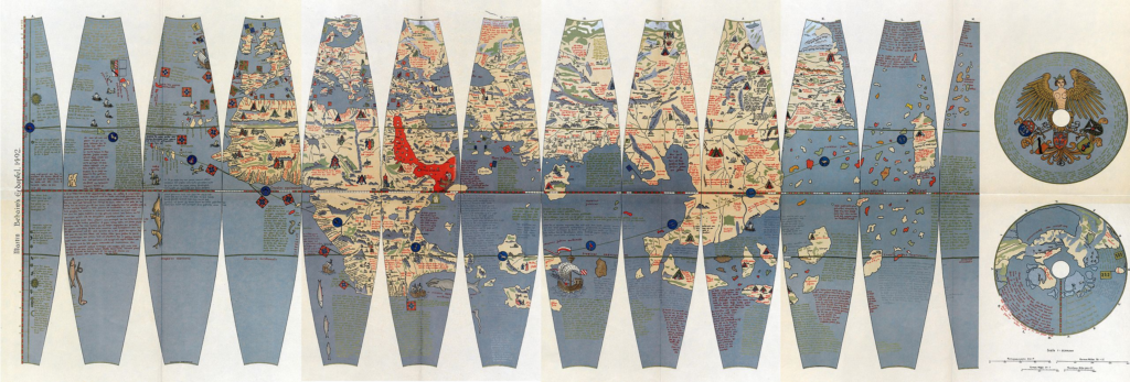
They didn't necessarily get better over time:
Modern satellite technology has revolutionized mapmaking and Earth observation with high resolution and multispectral imagery as well real time data. Having a GPS system in your pocket is a true privilege! There are countless sources for quality map files, like Google Maps, OpenStreetMap, or census bureaus. So why on Earth can it still be so hard to find reliable maps to visualize your own data?
Datawrapper offers a free-to-use library of approximately 4,000 basemaps from across the globe, primarily focusing on administrative boundaries. The library is regularly updated and expanded (by us on the maps team!) and most of the time these updates are driven by user requests. So if you want to see us add a map of Kirkjubæjarklaustur to the collection (it's a village in southern Iceland), all you need to do is to ask.
Because of that system, our basemaps tend to be where our users are. If we have have a lot of maps of some region, it's usually because people who live there send us a lot of requests. Fewer maps in other regions indicate fewer requests and/or a lack of reliable sources.
A lack of sources, even today? Well, each country is different! Different languages, different data storage methods, and sometimes (lots of times) different opinions on their own borders. Some countries are like the friend who shares everything, while others guard their data like a dragon hoarding treasure.
So yes, I must explain that it's sometimes impossible to add certain maps to our collection due to a lack of publicly available data. I always hate to disappoint, but I've been on the hunt for months after map data on Vsevolozhsky City or Jeddah City without any success. It's like hunting unicorns! Even with today's advanced technology, accessing certain information can still be challenging — some things still give us that ancient Babylonian vibe.
That was my first Weekly Chart! Come back next week to hear from Datawrapper's cofounder Mirko.


Comments