

What happened to the seven bridges in Königsberg?
February 2nd, 2024
5 min

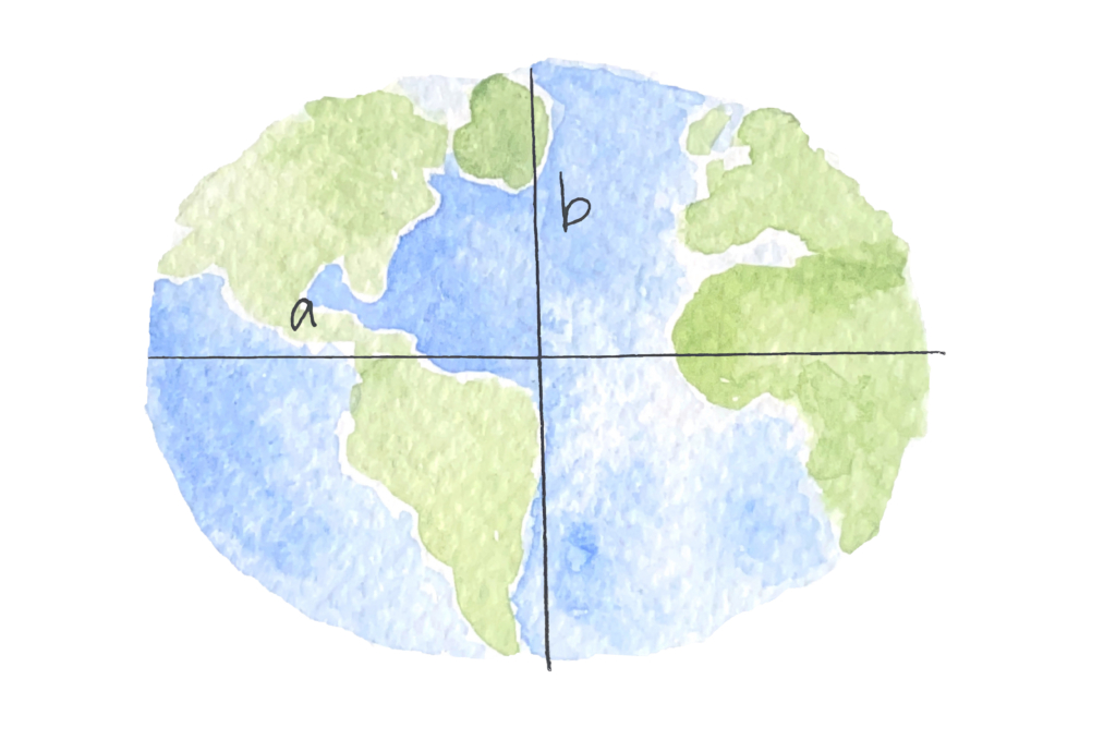
In the first Map Story we met Eratosthenes, who tried to calculate the size of the Earth almost 2300 years ago (and got really pretty close). Today we’ll meet a second guy, Friedrich Wilhelm von Struve, who revisited the same problem in the 1800s.
A lot had happened scientifically since Eratosthenes made his calculation. In his time, the general belief was that the Earth had the shape of a perfect sphere. But when Isaac Newton discovered gravity and centrifugal force in the 1600s, he also suggested that, because of its rotation around its own axis, the Earth would actually spread out into an ellipsoidal shape, like a sphere but flattened at the poles.
Of course, the changes weren’t just scientific. While Eratosthenes’ calculation was more of a theoretical experiment, now the measurement of the Earth has a concrete application: The age of European exploration and colonization had created a need for accurate mapping and navigation. General curiosity and interest in science that grew in the Age of Enlightenment combined with concrete political, military, and economic applications in navigation and mapping.
The weakest point in Eratosthenes’ calculation was his measurement of the distance between two far-apart locations. In 250 BCE, there was no better way to do this than by pacing out the distance on foot!
A much better method, triangulation, was established in the 1600s. Triangulation relies on a basic geometrical fact: Knowing the distance between two points of a triangle, plus the measure of their two angles, is enough to fully determine the location of the third point.
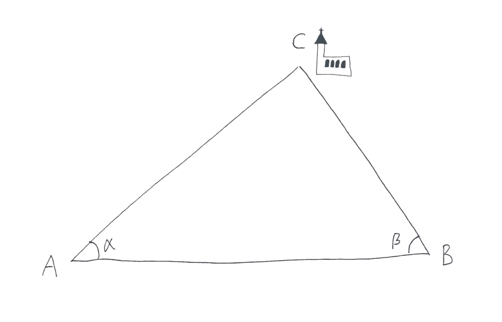
Using this fact, a surveyor can start from two relatively close points with a known distance and find the location of a farther point, and then a farther point, eventually creating a long chain of small triangles with precisely calculated locations. In theory, it could be a really, really long chain. Something like…
The Struve Geodetic Arc is a chain of 256 triangulation points, spanning from the north of Norway to the Black Sea. It was established between 1816 and 1864 with the purpose of measuring the flattening of Earth’s ellipsoid, and from there the size of the whole globe. Since 2005, the points in the triangulation network, including 34 marked with obelisks, have been a UNESCO World Heritage Site.
Today, the Arc stretches across ten different countries, the most of any UNESCO cultural site. Measuring it was a huge international project with hundreds of collaborators that took decades to complete. In this way, it has a lot more in common with the big scientific projects of today than with the methods of Eratosthenes’ time.
So who was behind it — and how did they get it done?
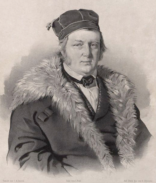
Friedrich Wilhelm von Struve was born in 1793 to an aristocratic family in Altona.
It was very unsettled time politically in Europe, with the dissolution of the Holy Roman Empire and the chaos of the Napoleonic Wars from 1803 to 1815. When Struve was born, his hometown of Altona was located in Holstein, the northernmost vassal state of the Holy Roman Empire — but (just to keep things confusing) the Duke of Holstein was actually the Danish king, and the duchy was administered as part of the Kingdom of Denmark. At the time, Altona was the second largest city in Denmark and an important trading city because it was close to river Elbe.
When the Holy Roman Empire dissolved in 1806, the status of Holstein was unclear. For a few years it remained under Danish rule, while the neighboring city of Hamburg was occupied by Napoleon. (Later, in 1815, Holstein would become a part of the German confederation under a personal union with Denmark.)
With Napoleon's army right across the river, Altona was also facing a potential occupation, so to avoid military service the family left Holstein and settled down in the city of Dorpat, in what was then the Russian Empire and today is Tartu, Estonia. Since the 13th century, Estonia had had a large German minority population. The University of Dorpat, where Struve went on to lead his research, had reopened in 1802 as a German-speaking institution and was the 11th largest university in Europe to use German as its teaching language.
In such an unsettled time, it’s easy to see why mapping for military purposes was really an important task. But an accurate framework for navigation and surveying was lacking.
The goal was to create one common, global geographic reference system. And for a global system, the flattening of the Earth’s ellipsoid is an important parameter. Expeditions sent in the 1730s to Peru and Lapland had already proved Newton's theory of an ellipsoidal Earth to be correct, but they were too small to make good estimates of the Earth's actual size.
The principle behind Struve’s measurements is exactly the same as the one Eratosthenes used 2000 years earlier: Measure a distance along some meridian and calculate its fraction of the Earth’s whole circumference. This time, triangulation would allow for a more accurate measurement of the distance, and the discovery of gravitation and the Earth’s flattened shape would allow for a more accurate calculation.
To measure the size of the whole world, the triangulation chain needs to be really large — and that’s not just a scientific challenge, but an institutional and political one. But in this case, the political map of the era actually worked to Struve’s advantage:
In its own day, the Arc crossed only one international border, between Sweden-Norway and the Russian Empire. In Russia a major surveying campaign had already begun in 1816, with the goal of creating a triangulation network across the entire Empire; it was led by Karl Tenner, a colonel in the Russian army. Struve presented a more scientific approach, which would also determine the dimensions of the Earth, to Czar Alexander I in 1819. Luckily, science was one of the czar’s top interests, so Struve got all the resources he needed to join forces with Colonel Tenner and start the daunting task of setting up triangulation points from the northern coast of Norway all the way to the Black Sea. Struve chose his hometown of Dorpat as their point zero; Colonel Tenner and his team started to build the chain southwards from there while Struve’s team traveled north.
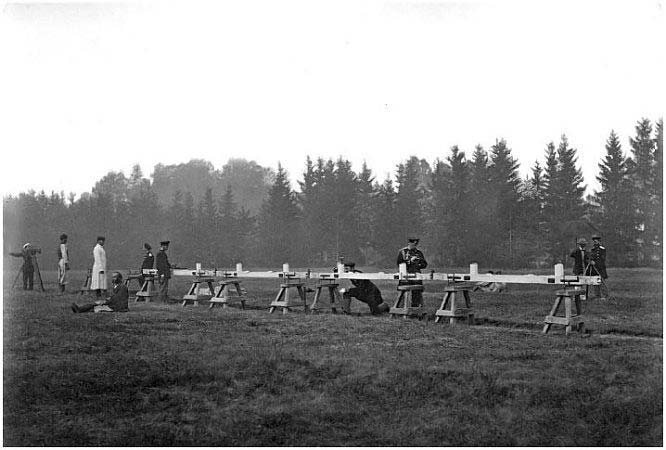
In total, the chain had 258 triangles formed by 256 measurement points, which were marked by anything from a simple hole drilled in a rock to a commemorative obelisk. Observations of latitude were made at 13 selected stations, giving 12 arcs from which to compute the length of 1º of curvature. (The further north you go, the longer one degree is — a reflection of Earth's ellipsoid shape.) Ten triangle sides in the network were measured directly using a set of wrought iron bars laid end-to-end.
The measurement campaign took almost 40 years. Struve was able to conclude that the length of the meridian arc was 2,821,833 meters. Unfortunately, he became ill and died before the results could be fully compiled and so was unable to determine the curvature and full size of the Earth himself. But the project's measurements ultimately resulted in a calculation for Earth's semimajor axis of 6,378,398 meters, within three hundred meters of the value that's used today.
Struve was very thorough when he marked the triangulation points, and almost all of them can still be found today. It’s amazing to consider the determination that was needed to coordinate so many people on such a large project using the tools of the day, and what an accurate result they were able to achieve together. In fact, triangulation remained the most accurate method for measuring long distances until very recently — when the invention of satellite navigation systems in the 1980s meant it was time to measure the world again.
I hope you're enjoying these Map Stories — until next time!


Comments