


New: Stay organized with a more powerful, faster visualization archive
June 25th, 2024
3 min
This article is brought to you by Datawrapper, a data visualization tool for creating charts, maps, and tables. Learn more.
With Datawrapper, you can create maps for over 600 different map regions around the world, including hundreds of common and not-so-common areas – from a simple world country map to a municipality-level map of Berlin. However, sometimes even 600 maps give you not enough choice. That’s why we’re introducing a much-requested feature today that allows you to create maps that only show a particular part of a larger map.
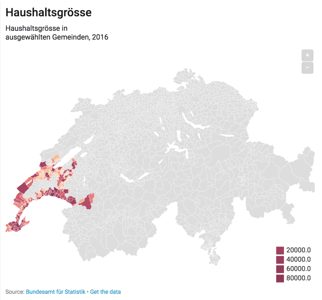
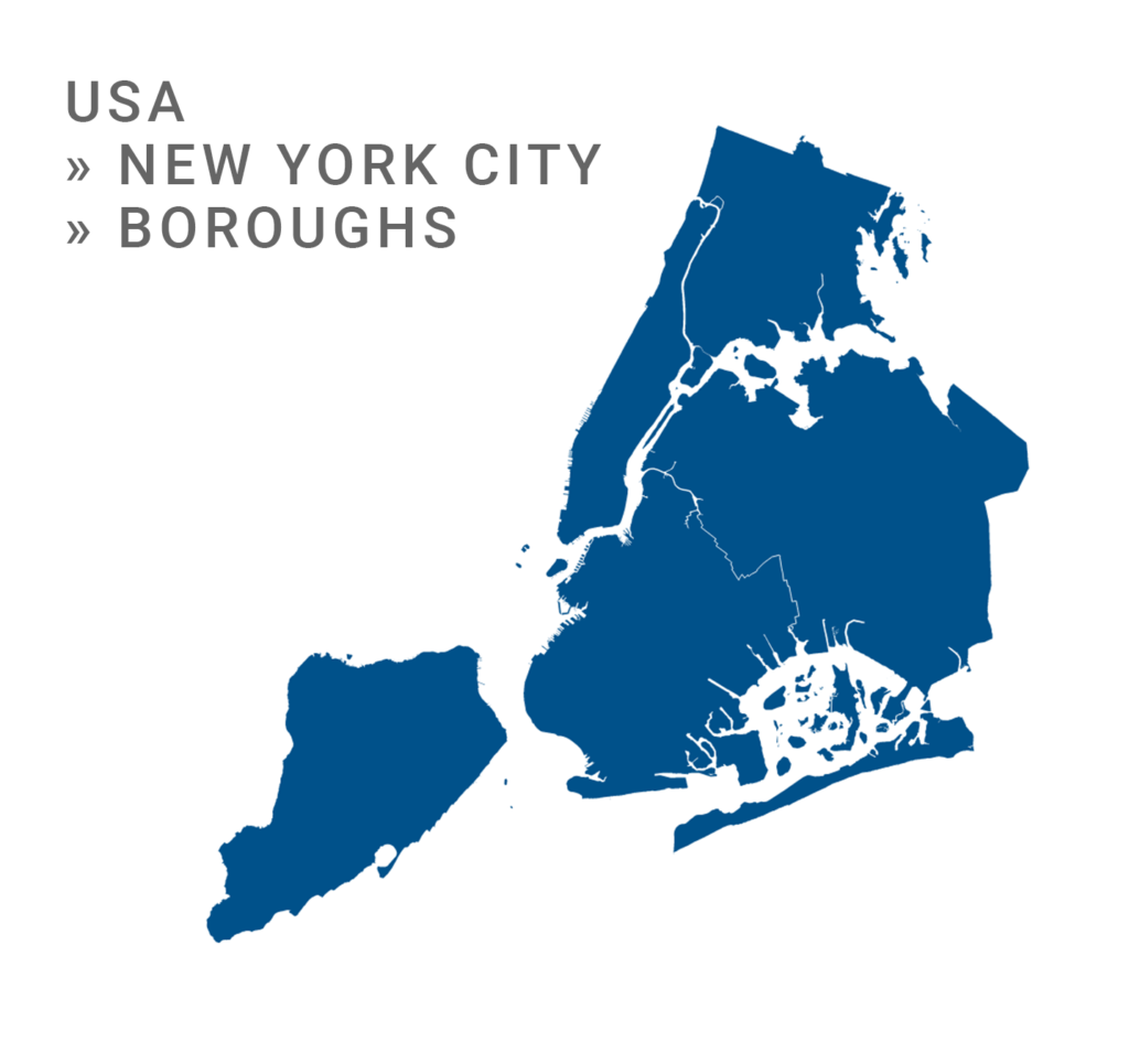
For example, as a local newspaper, you might want to create maps that show the particular 10 counties of your area of circulation. Now, you can simply add the data for those counties to your map in Datawrapper while leaving the rest blank, and check the newly updated “Hide regions without data” checkbox. Datawrapper will automatically hide all other parts of that map and zoom into the regions you want to show. Here are three examples:
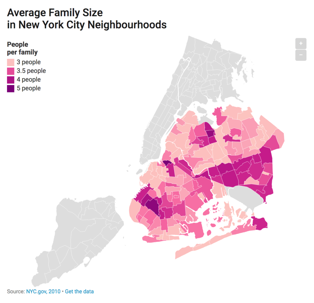
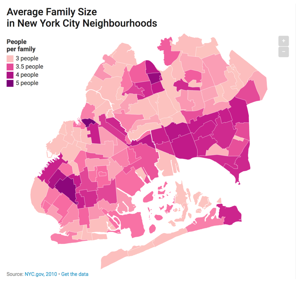
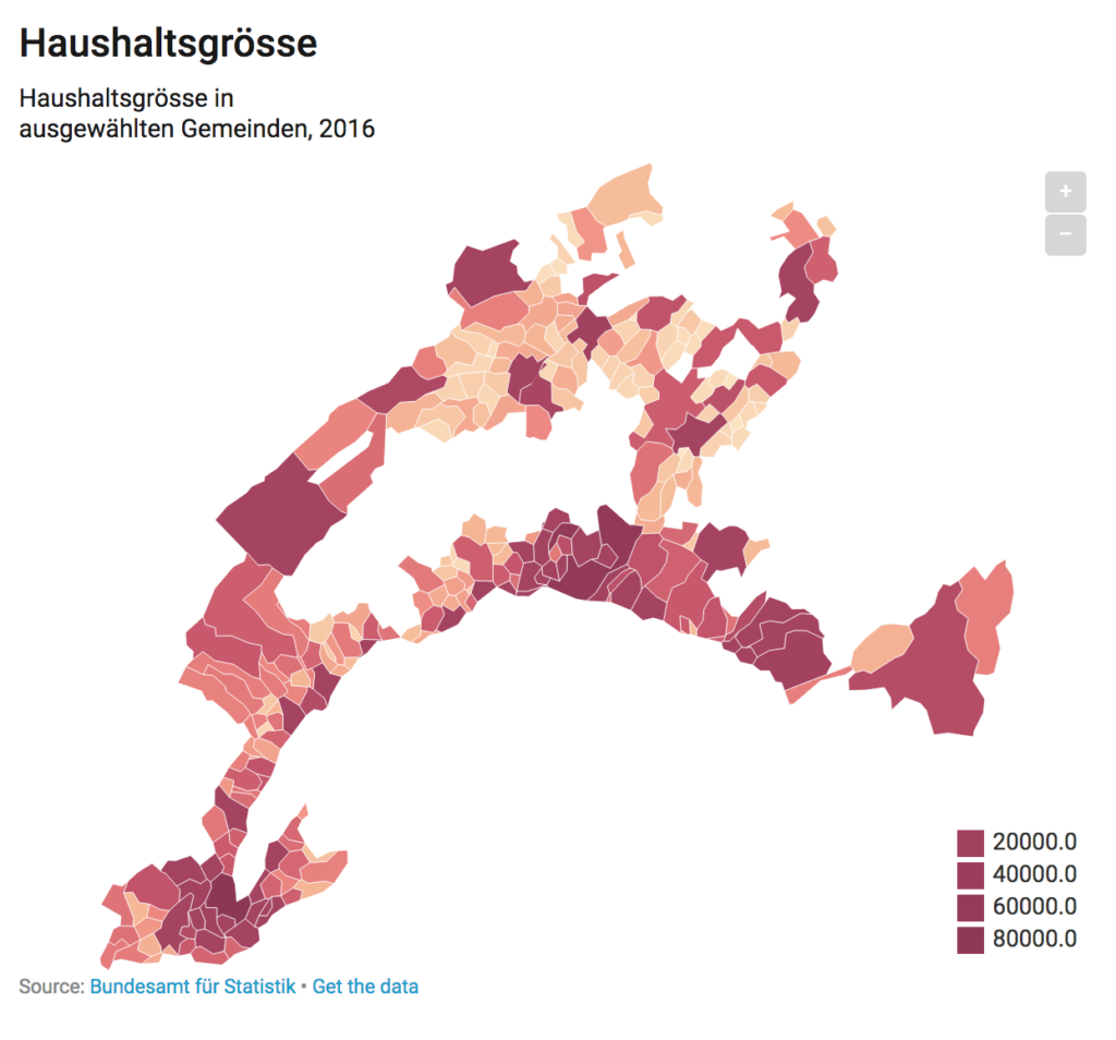
The result will be a map with a new map view. That means, your readers can still zoom into the map, but they won’t be able to zoom out anymore. To try it for yourself, have a look at this map of Brooklyn and Queens that we created with our map of New York City. Hover over the map and click “Edit this chart” in the top-right corner to toggle the “Hide regions without data” yourself in our mapping tool:
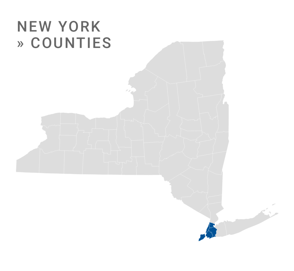
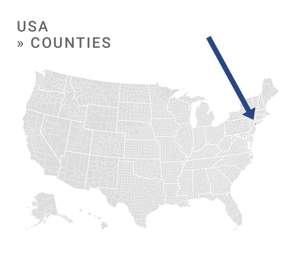
As you might know, we already have a lot of maps that are subsets of other maps. For example, we have a county map of the whole US and also individual county maps for all states. With our new “Hide regions without data”, you could theoretically create a county map of the five boroughs of New York City with our map of all US counties. However, we don’t recommend that because of a simple reason: Your map will look bad. The more regions a map has (e.g. 3000 counties) the more we simplify them, to make sure that the map displays quickly for your readers:

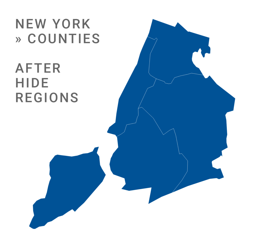
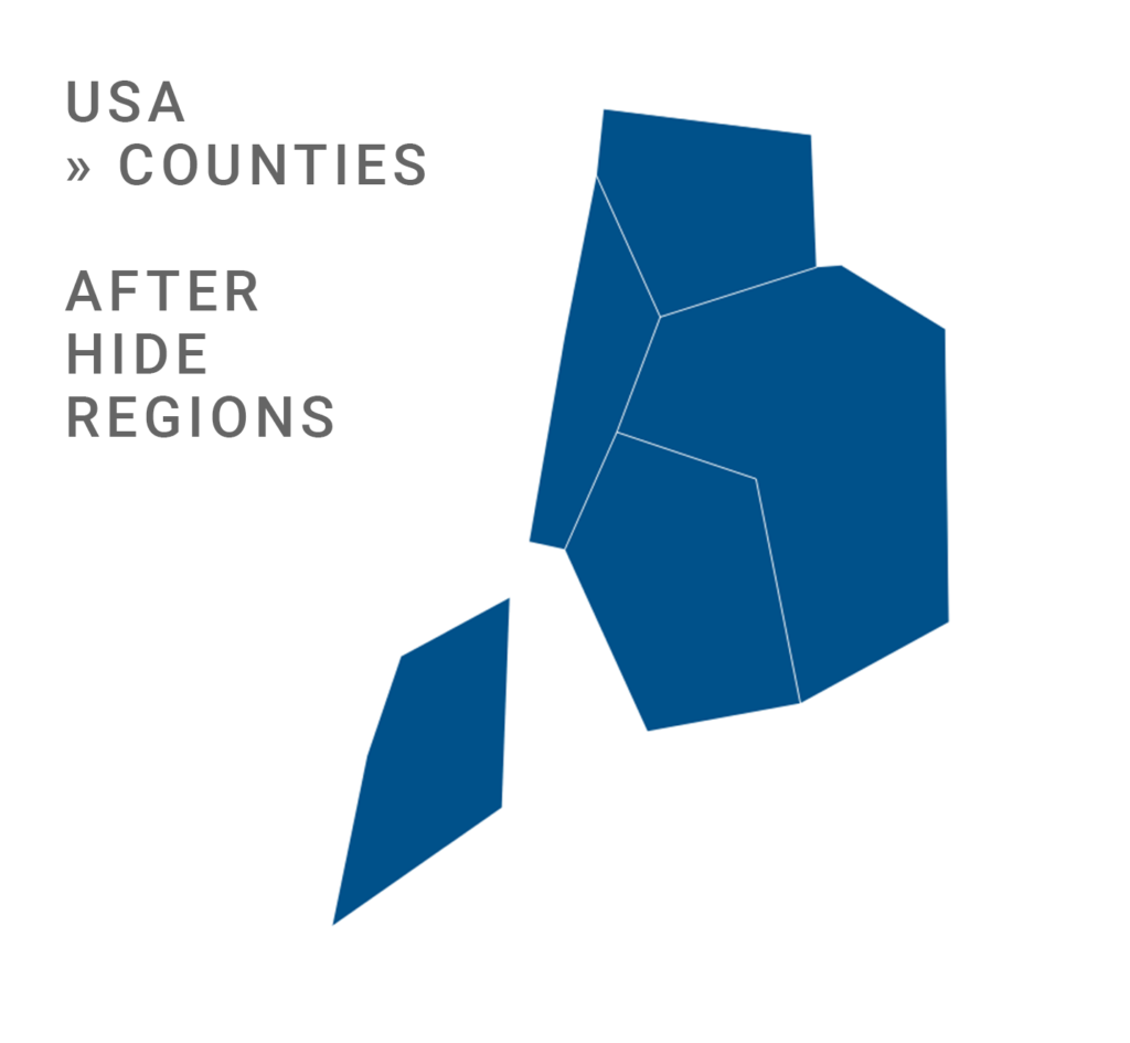
So the more regions you hide from the original map, the more simplified the remaining regions will be. To create a useful map, always choose the Datawrapper map in which your data already covers the most regions.
We hope that this new feature will let you create exactly the maps you’ll need. If you’re looking for administrative boundaries we don’t feature yet, please write us at support@datwrapper.de. We have a new addition to our team, Anna, who will be responsible for everything map-related and will take care of your requests.
Comments