


New: Stay organized with a more powerful, faster visualization archive
June 25th, 2024
3 min
This article is brought to you by Datawrapper, a data visualization tool for creating charts, maps, and tables. Learn more.
A year ago, we launched locator maps – a map type you can use to show your readers where something has happened or is located.
We’re happy to tell you that our locator maps now come with a shaded relief or “hillshade”. Which is a fancy form of saying that readers will now be able to see mountains and valleys in your locator maps. Be it the the Andes, the Alps, Mount Everest or just the hill at the edge of your town: All terrain that goes up will now be visibly doing so.
Our shaded relief is available between zoom levels 3 and 12, and gets more detailed the more you zoom in.
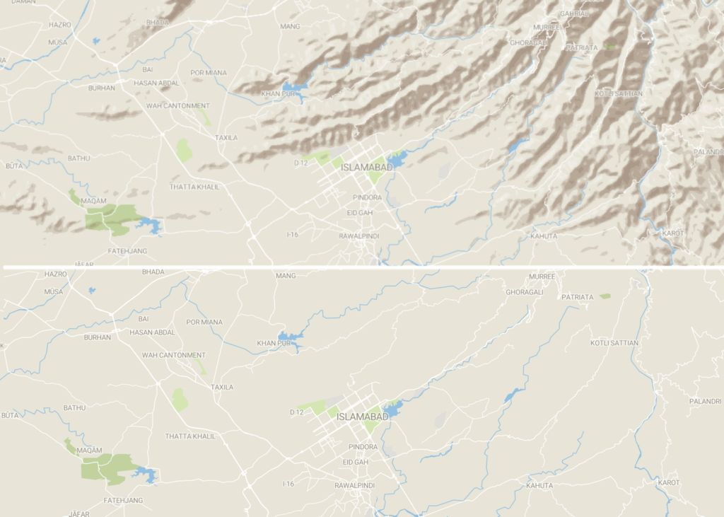
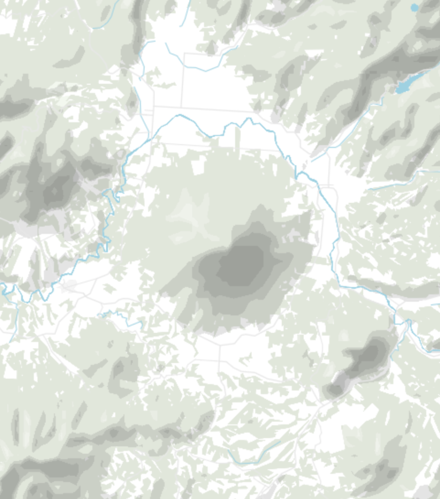
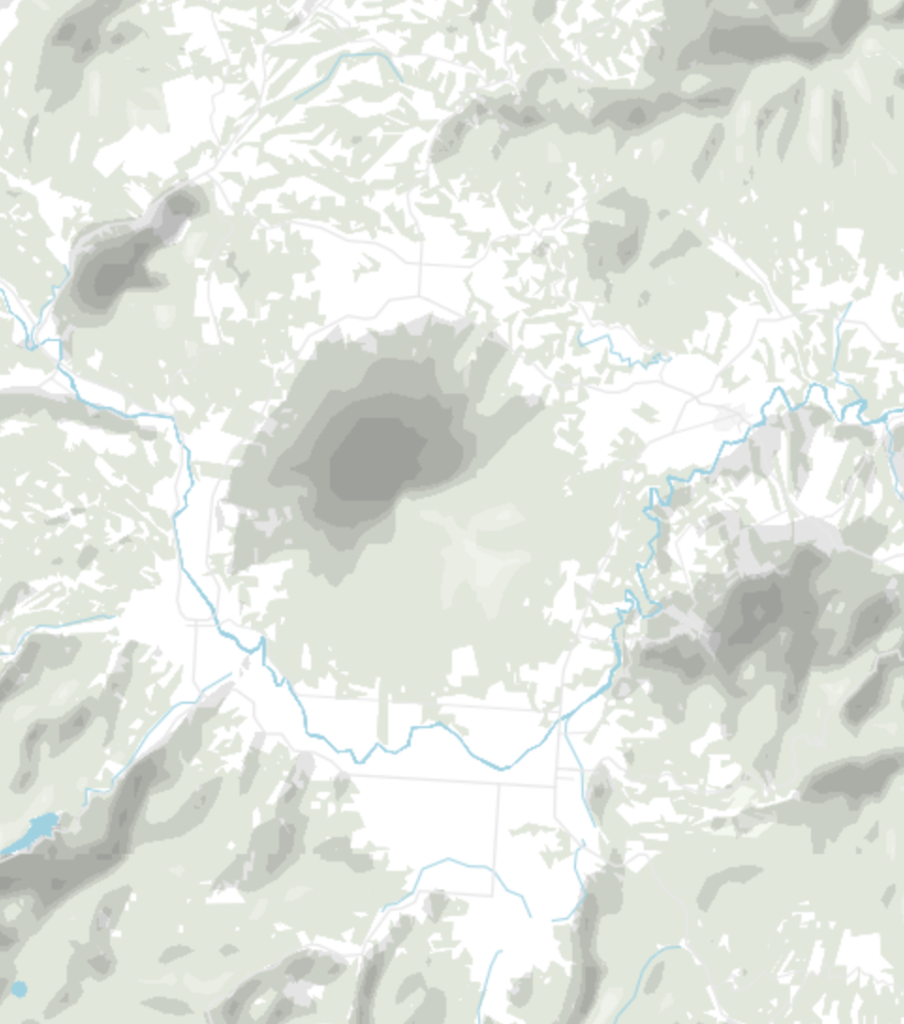
The shaded relief turned on and turned off. It can add some valuable context.
Here’s more happy news: Our freshly announced full-vector export for locator maps also includes the new shaded relief. You can change the colors, opacity, etc. of the hillshades after exporting the locator map as an SVG or PDF.
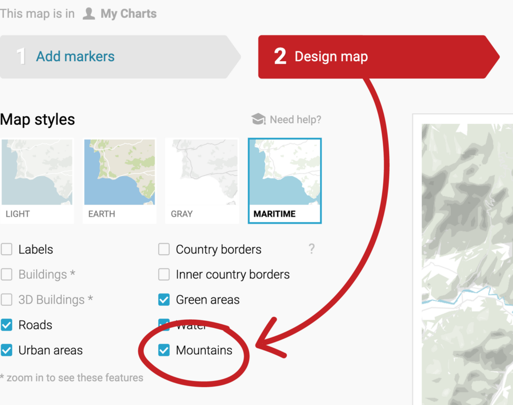
You can show shaded relief on your locator map by clicking one tiny checkbox. It’s turned off by default, so don’t miss it: Create a locator map (click here or click “Create a map” on our maps page) and then enable the checkbox Mountains in step 2: Design map. And that’s it! You should immediately see mountains and hills.
To make our new shaded relief possible, we downloaded elevation data from NASA, generated the shaded relief with some calculations, and turned it into vector data.
On each supported zoom level, we then designed six layers of shades: Two shades for the bright north-west side of the mountains on which the sun shines, and four shades for the dark south-east side of the mountain. If you own a custom design theme as part of a Custom or Enterprise plan, you can define your colors for the bright and dark side in your shaded relief – simply get in touch with us at support@datawrapper.de and let us know which colors you’d like.
But why north-west and south-east, you ask? It’s not an arbitrary decision we’ve made: When the light comes from the upper left, we humans perceive mountains as mountains – and not as valleys. So don’t rotate a locator map with a shaded relief too much. It will lead to “relief inversion” and look a bit odd.
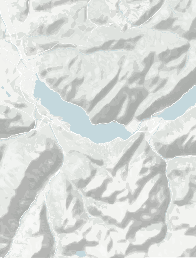
Here’s an example:
Left: The light comes from the top left.
Right: The light comes from the bottom right.
With the six layers of shades we create a visual illusion of mountains and valleys. But they are not shown in 3D (as opposed to e.g. our 3D buildings). That’s why our shaded relief blends out if you tilt your map.
You will see a little warning below the Mountains checkbox that indicates when you zoomed in or tilted too much to see the shaded relief.
Just play around! We’re looking forward to seeing what you will create with the new maps.
Thanks to our map professional Anna Thieme for preparing the shaded relief, to our locator map specialist Hans Hack for styling it and integrating it into our locator maps, and to our backend developer Hendrik Bartusch for rendering the map tiles. We hope you like the mountains that you can now show on your locator maps! As always, we’re eager to hear what you have to say at support@datawrapper.de . Do you have any comments, feedback, questions? Let us know!
Comments