

What happened to the seven bridges in Königsberg?
February 2nd, 2024
5 min

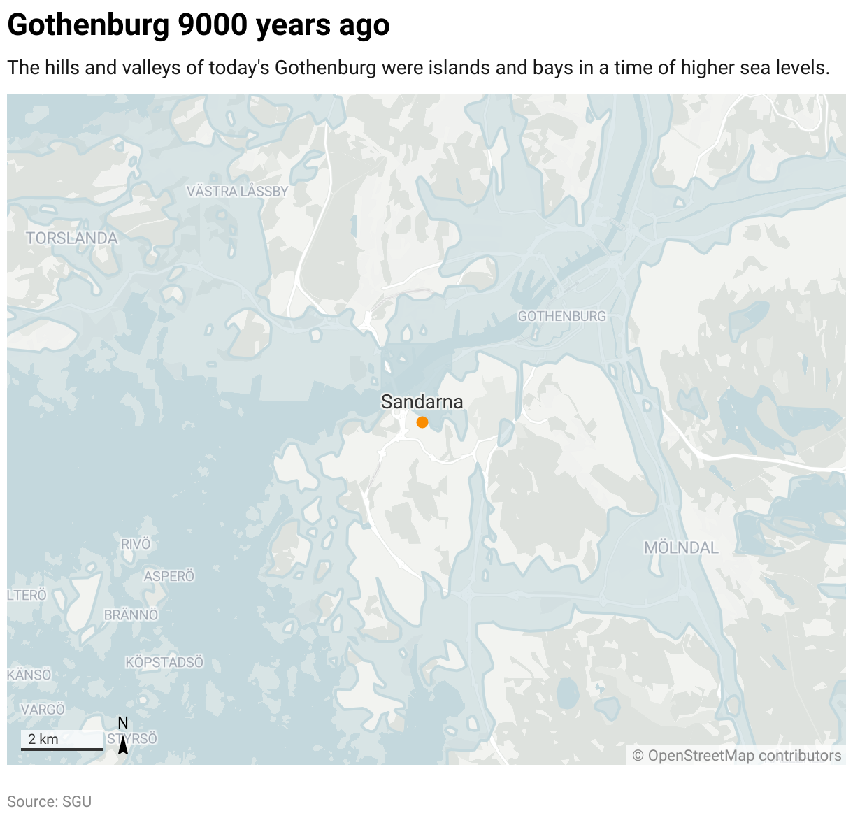
Sandarna is a famous archaeological site in my hometown, Gothenburg. It started as one of the first permanent human settlements in all of today’s western Sweden, and was probably inhabited by a group of 10-15 people over a period of 1000 years, from 9000 to 8000 years ago.
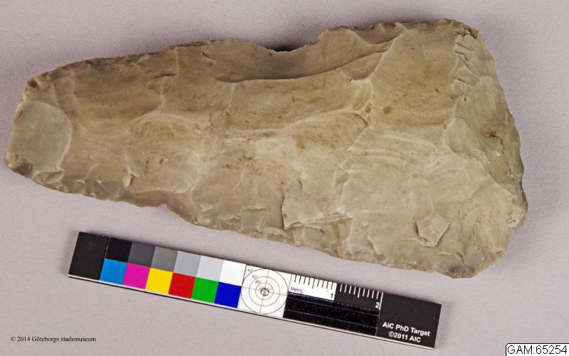
The site today is very rich in archaeological finds, including flint axes, scrapers for preparing animal hides, arrowheads, and leftovers from tool production. Sandarna has given its name to this special type of axe, as well as an entire culture in prehistoric western Sweden that used a similar set of tools. I’ve always enjoyed imagining these first Gothenburg settlers living on their little island that is now a hill in a densely populated urban area.
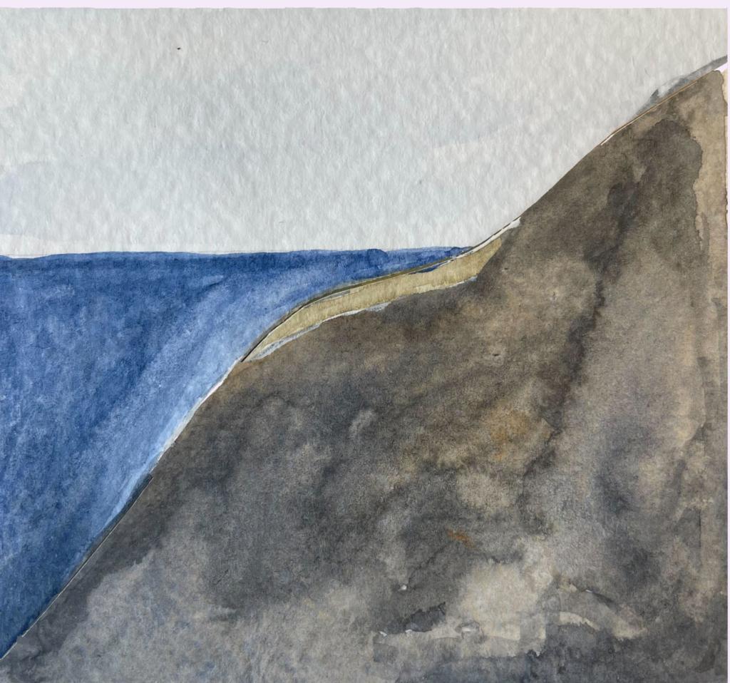
How can an island become a hill? As the sea level rises and falls over time, the moving shoreline can create many different landscapes in the same area. What today is mountains and hills would have been islands in a time of high seas, and the valleys were bays or lakes. The location of the shoreline also creates geological phenomena such as seawalls, shell gravel banks, pebble fields, and bare rock surfaces, and can explain why the landscape looks like it does today. The location of the shoreline is of great importance in archaeology as it allows us to mentally place archaeological sites in their proper landscape setting and understand how people lived in them.
In this map story, we’re going to take a look how the sea level changed in Scandinavia after the last ice age, in particular at the Mesolithic (or Middle Stone Age) settlement of Sandarna.
For 100,000 years of the Weichsel Glacial Period, almost all of Scandinavia was covered with 4 kilometers of thick ice. Not much could live or grow in that environment! People didn’t come to the region until about 15,000 years ago, when the climate got warmer and some of the ice started to melt. The first people to arrive in the tundra-like landscape the ice left behind were hunters, following the reindeer to new grazing grounds. The climate was still too hard for these hunters to settle down, so this was mostly summer expeditions.
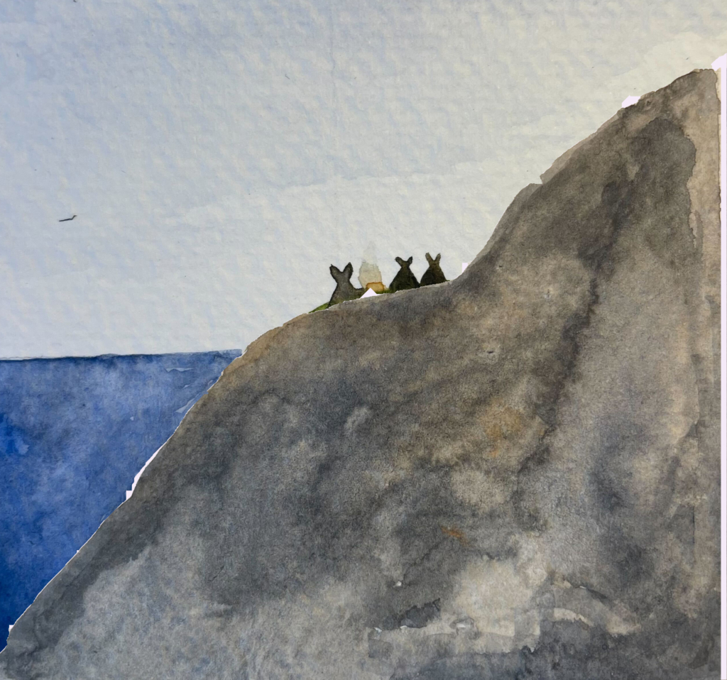
Around 9000 years ago, the climate had become even warmer and more pleasant in the Gothenburg area, and smaller groups of hunter-gatherers started to settle permanently, including in Sandarna. As they were mainly getting their food from the sea, most of them chose to live by the shore.
At the time Sandarna was settled, the sea level around Gothenburg was 20 meters above the sea level of today. The settlement was located off the area’s northern shore, on an island in the bay, protected from the wind. But in the years since then, the sea has drawn back. Sandarna was rediscovered in 1930s — now sitting on a hillside attached to the mainland — when the city of Gothenburg was expanding and needed new land for housing.
At the end of glacial period, the climate became warmer and ice started melting into the ocean.[1] That extra water caused the sea level to rise globally by around 120 meters, meaning that most ancient coastlines around the world are now covered with water. So why is Sandarna farther than ever from the sea?
Ice is heavy. In regions like Scandinavia that were covered by thick ice sheets, the weight was so heavy that it was physically pushing down the land. When the glaciers melted and that pressure was released, the land “bounced back up” — a phenomenon called post-glacial rebound.
While rising sea level is a global process, post-glacial rebound is more regional and varies from place to place, depending on the local geology and how long ago the area was released from its ice. The two processes also work at different rates over time, so their net effect varies; at any one location, the shoreline will sometimes be rising and sometimes drawing back.
This chart shows how sea level changed in the Gothenburg area during the end of the last glacial period:
From 13,000 to 10,000 years ago, the shoreline was quickly drawing back, uncovering more and more land from the water. This was the period when glaciers were sliding off into the sea, and rebound from the weight of the ice was strong. The land was rising up out of the water by as much as 30 millimeters per year!
But the all that ice didn’t just stay frozen. Around 9000 years ago, the world climate reached an especially warm period known as the Holocene Climatic Optimum, and both land and sea ice was melting rapidly into the oceans. The post-glacial rebound couldn’t keep up with the increasing amount of seawater, and sea levels started to rise again.
As Stone Age people in Scandinavia often chose to live close to the shore, rising seas between 10,000 and 8,000 years ago caused many settlements to be slowly flooded and covered with sediments. By measuring the height of an ancient settlement above today’s sea level and matching it with a time on this graph, we can get a rough estimate of when that settlement was inhabited (together with other methods like analysis of stone tools and carbon dating of organic materials).
By 8,000 years ago, most ice had finished melting. With the land still slowly rising, shorelines started to fall again, and areas that had been flooded reemerged from the water.[2] One reason these settlements are such rich archaeological sites is that the thick layer of clay and sediment left by the flooding makes them bad for agriculture, which protected them from being “disturbed” in later years. The stone tools under the clay can tell us a lot about how people lived — and we’ve even found some organic materials, like an ancient roasted hazelnut. Excavations on top of the clay layer indicate that Sandarna was settled again around 5000 years ago.
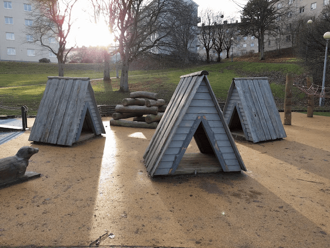
Over the millennia, the landscape has changed and the way people live has changed, but the area that now is Gothenburg has been continuously inhabited. What, 9000 years ago, was a settlement of 10–15 people on an island shore is now a slope in the middle of a popular neighborhood with buildings from the 1930s. In the last few years, new housing projects have been planned at Sandarna, and a Stone Age themed playground is the only visible reminder of the neighborhood’s early beginnings.
And that's my second Map Story — I hope you're enjoying reading along. See you next time!


Comments